Aarhus University Seal

tTEM

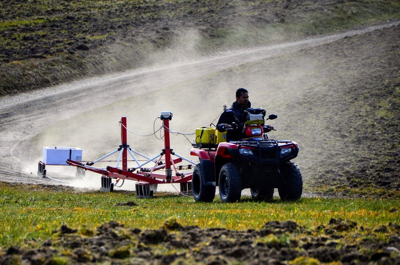
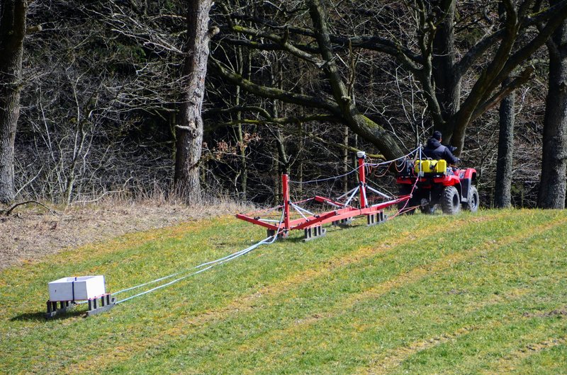
The tTEM-system is a towed, ground-based, transient electromagnetic system, designed for detailed 3D geophysical and geological mapping of the shallow subsurface (0-80 m) in a fast and cost efficient way. The detailed 3D coverage is obtained by fast data repetition and a small line spacing of typically 10-20 m.

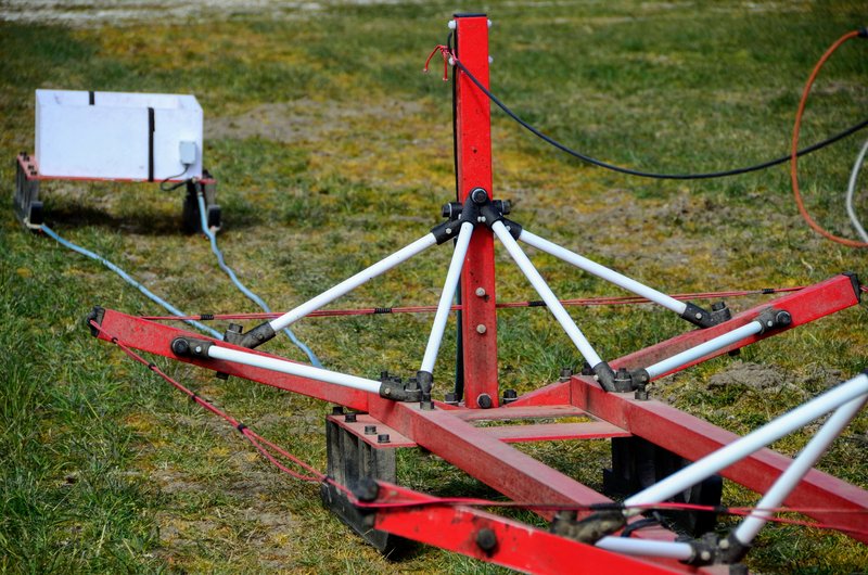
The tTEM system is quick to deploy and easily managed by a field crew of two persons. The tTEM-system consists of an ATV, carrying the instrumentation and towing the transmitter frame and the receiver coil. The transmitter and receiver coils are mounted on sleds for a smooth ride over rough fields/terrain.

The tTEM data processing is fully integrated with the Aarhus Workbench software package.

The tTEM system also comes in a FloaTEM version operating on water.

Contact Aarhus GeoInstruments regarding rental or purchase of a tTEM system.


Key Specifications

  • Dual moment towed TEM-system
  • Offset configuration, offset: 9.5 m
  • Depth of investigation: 50 - 100 m
  • Drive speed: 4-5 m/s (15-20 km/h)  
  • Daily production rate on farm fields: 100-250 hectares
  • Peak current: 30 Amp (high moment)
  • Transmitter moment:  19, 240 Amp/m2 (low, high moment)  
  • Transmitter period time: 0.6 ms, 1.4 ms (low, high moment)
  • Turn off time: 2.5 microseconds (low moment)

Documents

Key system paper

  • A Towed TEM system for Detailed 3D Imaging of the Top 70 meters of the Subsurface: Geophysics. Auken, E., Foged, N., Larsen, J. J., Lassen, K. V. T., Maurya, P. K., Dath, S. M., and Eiskjær, T.,
    2018 - pdf

Reports

  • The tTEM System - System validation and comparison with PACES and ERT,
    December 2019 - pdf

Case studies papers

  • Assessment of managed aquifer recharge sites using a new geophysical imaging method: Vadose Zone Journal. Behroozmand, A.A., Auken, E., Knight, R., 2019. - pdf
  • A new towed geophysical transient electromagnetic system for near-surface mapping, Preview. Auken, E., Pedersen, J. B. & Maurya, P. K., 2018,33-35. - pdf