Data acqusition
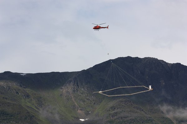
To achieve the challenging tasks of the AQUIM project and get the best possible geophysical data for the geological and hydrological modeling over extremely extended areas, the HGG will use the SkyTEM system which has been developed at Aarhus University.
The SkyTEM system in action.
SkyTEM is a heliborne system for the acquisition of time-domain electromagnetic data. It had been designed specifically to provide the same accuracy previously possible only with ground surveys. It is the only airborne system capable of operating in dual transmitter modes:
Data processing, inversion and presentation
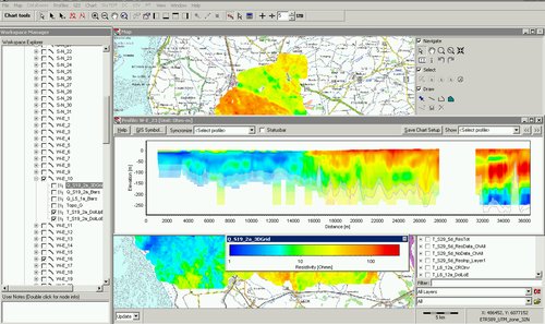
After the acquisition, collected data will be processed, inverted and interpreted by using the software package developed by the HGG. The Aarhus Workbench software package integrates all steps in the workflow: from the raw recorded time-domain electromagnetic data, it is possible to reconstruct and effectively visualize the electrical conductivity distribution of the subsoil. Moreover, within Aarhus Workbench framework, further comparisons can be made with other available geological information in order to infer the best hydrogeological model.
Example of presentation of survey results in Aarhus Workbench - GIS interface and profile section.
Aarhus Workbench includes a GIS-platform together with a robust and flexible database storing system. On one hand, the database holds data from the different processing and inversion steps to guarantee full quality control; on the other hand, the advanced visualization capabilities connected to the GIS makes data interpretation as easy and effective as possible.
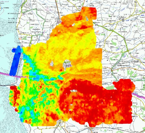
Example of presentation of survey results in Aarhus Workbench - Meanresistivity map.
A considerable part of AQUIM project will be spent on the training of Indian researchers and technicians in the use of Aarhus Workbench.